Satellite-enabled apps can improve agriculture from space. Here's how
Space technology is transforming how we do things on Earth these days. But it is perhaps in agriculture that the impact is being felt particularly strongly and has the potential to transform how the sector operates by 2030.
Free or affordable space images traditionally have not been good enough to be meaningful on the ground and the ones with higher resolution have just been too expensive.
But that is changing now and over the next few years, both the cost and quality of imagery could be at a point where using it consistently could help deliver significant savings for farmers as well as help provide better planning for those working across the rest of the sector – everyone from logistics providers to insurance, governments and traders.
How space applications can benefit agriculture
As the Space Applications in Agriculture: Enhancing Food and Water Security, Improving Climate Action issue briefing published by the World Economic Forum in collaboration with McKinsey & Company highlights, space applications can deliver significant overall impact in agriculture over the coming years, but only if certain actions take place.
A few significant numbers in the report jump out. For example, identification of early-stage pests by hyperspectral and optical satellite imagery, if applied at scale, could help salvage up to 0.8 billion tonnes of crops annually.
Similarly, helping reduce inputs – such as pesticides and fertilizer – could save up to 50 million tonnes of carbon dioxide emissions per year, while water usage could be reduced by 5-10% – that’s up to 2.8 billion litres of fresh-water – from satellite-informed irrigation improvement.
Considering that the agricultural sector is a key global emitter of greenhouse gases and consumes close to two-thirds of global freshwater withdrawals, these numbers are important.
These societal benefits deliver economic returns as well. Food waste reduction could contribute an additional $150-175 billion in economic value for producers, according to analysis of data from the UN Food and Agriculture Organization, and a 5% cost reduction represents $7-8 billion for growers from input savings alone.

Space applications' potential to address challenges in agriculture Image: McKinsey
So how does this all work in practice? Space-based remote sensors collect and facilitate the exchange of a multitude of data, including weather information and imagery from optical, hyperspectral and multi-spectral domains, which can drive advanced analytics methods to provide insights in the field and across seasons.
We see these improving technologies, coupled with growing supply, bringing increased adoption over the next decade across five use cases:
-
Yield estimation: using satellite data and analytics to generate accurate and regionally specific estimates of expected crop production, by crop type, to quantify and act on food demand gaps, predict crop prices, or align logistics to harvest areas.
-
Yield optimization: using satellite data to power advanced analytics that identify intra-field crop defects, informing actions and operations to maximize production per acre by using resources more efficiently.
-
Bolstering sustainable practices: applying satellite insights to help reduce emissions, use less water, and encourage regenerative practices.
-
Predicting, verifying and mitigating damage from natural disasters with satellites’ unique ability to remotely monitor conditions before and after droughts, fires and floods.
-
Enabling autonomy and continuous monitoring via satellite-based connectivity in remote areas with poor mobile broadband coverage.
How satellites could be used in agriculture
For many of these use cases, satellites compete with unmanned aircraft vehicles, commonly known as UAVs or drones; fixed wing aircraft or high-altitude platforms such as balloons. However, satellites offer advantages at scale and eliminate the need for large, ground-based operations.
In some specific cases where extremely high resolution (3cm by 3cm) is needed or when there is persistent cloud cover, drones may still have a role in the future. But as satellite resolution improves and costs come down, these space-based tools could become an integral part of the sector.
Another likely scenario could see a hybrid model emerge, where a joint use of the different platforms can appear, with drones being used to verify data coming from satellites or providing sets of data which would be extrapolated to entire areas through satellite data with the help of artificial intelligence.
Importantly, we estimate the blended cost of high and very-high-resolution satellite imagery to decline 25% to 50% by 2030, bringing satellite imagery costs to a competitive level with that of equivalent-quality fixed wing and unmanned aerial vehicles, as their costs are likely to remain stable.
New customer groups, including carbon traders and insurers, are also likely to be attracted by what satellite data can provide, due to improved costs and operating models. In combination with expanding its reach to existing customers such as governments and the agriculture industry, we project adoption to grow the market ~10% annually and reach up to $1 billion by 2030.
In McKinsey & Company’s 2022 digital farmer adoption survey, 29% of row crop farmers and 45% of specialty crop farmers in the US said they currently employ remote sensing, or plan to, in the next two years and numbers are even higher in South America and Europe. With younger operators increasingly aging into management roles, adoption will increase – already 60% of users are under 44 years of age.
Co-ordinated efforts needed to increase uptake
Yet it will take coordinated efforts among disparate stakeholders to make greater adoption a reality. Greater confidence can be achieved by involving users in the technology development roadmaps, ensuring a tight linkage between user needs and insights.
Providing transparency into how insights are derived, highlighting where they are most accurate or fall short, is also critical for building trust. Ultimately, testimonials and proven value creation will be the true test.
Getting model accuracy to reliable levels requires a high investment of manpower, while data gathered on the ground is required to train analytics models and validate what the images predict. Such data is costly and will require substantial cross-industry collaboration.
Archival imagery and real time imagery will be required by satellite companies to help insight developers train their algorithms, while growers should ensure ground-truth data availability by leveraging cooperatives, commodity boards, and other networks.
Governments, non-governmental organizations and analytics companies can make data-sharing easy, anonymous and beneficial for growth to growers who participate.
Commercial satellite applications have therefore an opportunity to become a much bigger part of the agriculture sector over the coming years, and everybody stands to gain.
You can read the original post, published on the World Economic Forum’s Agenda site on 10 May 2023, by clicking here.
techUK – Unleashing UK Tech and Innovation
The UK is home to emerging technologies that have the power to revolutionise entire industries. From quantum to semiconductors; from gaming to the New Space Economy, they all have the unique opportunity to help prepare for what comes next.
techUK members lead the development of these technologies. Together we are working with Government and other stakeholders to address tech innovation priorities and build an innovation ecosystem that will benefit people, society, economy and the planet - and unleash the UK as a global leader in tech and innovation.
For more information, or to get in touch, please visit our Innovation Hub and click ‘contact us’.
Latest news and insights


Other forms of content
Sprint Campaigns
techUK's sprint campaigns explore how emerging and transformative technologies are developed, applied and commercialised across the UK's innovation ecosystem.
Activity includes workshops, roundtables, panel discussions, networking sessions, Summits, and flagship reports (setting out recommendations for Government and industry).
Each campaign runs for 4-6 months and features regular collaborations with programmes across techUK.
techUK's latest sprint campaign is on Robotics & Automation technologies. Find out how to get involved by clicking here.
Running from September to December 2023, this sprint campaign explored how the UK can lead on the development, application and commercialisation of space technologies, bring more non-space companies into the sector, and ultimately realise the benefits of the New Space Economy.
These technologies include AI, quantum, lasers, robotics & automation, advanced propulsion and materials, and semiconductors.
Activity has taken the form of roundtables, panel discussions, networking sessions, Summits, thought leadership pieces, policy recommendations, and a report. The report, containing member case studies and policy recommendations, was launched in March 2024 at Satellite Applications Catapult's Harwell campus.
Get in touch below to find out more about techUK's ongoing work in this area.
Event round-ups
Report
Insights
Get in touch

Rory Daniels
Rory Daniels
Rory joined techUK in June 2023 after three years in the UK Civil Service on its Fast Stream leadership development programme.
During this time, Rory worked on the Government's response to Covid-19 (NHS Test & Trace), school funding strategy (Department for Education) and international climate and nature policy (Cabinet Office). He also tackled the social care crisis on secondment to techUK's Health and Social Care programme in 2022.
Before this, Rory worked in the House of Commons and House of Lords alongside completing degrees in Political Economy and Global Politics.
Today, Rory leads techUK's five-strong Emerging Technology and Innovation team, working with many of the UK's most innovative tech companies to convene experts and decision-makers, showcase best practice, shape government's thinking, and ensure the UK leads on developing and deploying transformative technologies.
The team's main areas of focus are AI Innovation, Quantum, Semiconductors, Robotics, Photonics, Neuromorphic, Innovation Policy, and Technology Convergence.
Rory sits on DSIT's expert Robotics Advisory Group, hosts techUK's Meet the Innovators video interview series, and chairs techUK's Emerging Tech Leadership Committee, comprising 36 senior leaders from the UK's most exciting tech companies. He has also judged the Global Space Awards, hosted London Tech Week's Deep Tech Stage, completed Stanford University's Tech & Entrepreneurship residency, and given oral evidence in a House of Lords Select Committee.
In his spare time, Rory enjoys photography, reading non-fiction (tech, architecture, design & geopolitics), and searching for London's best burger.
- Email:
- [email protected]
- LinkedIn:
- https://www.linkedin.com/in/rorydaniels28/
Running from January to May 2024, this sprint campaign explored how the UK can lead on the development, application and commercialisation of the technologies set to underpin the Gaming & Esports sector of the future.
These include AI, augmented / virtual / mixed / extended reality, haptics, cloud & edge computing, semiconductors, and advanced connectivity (5/6G).
Activity took the form of roundtables, panel discussions, networking sessions, Summits, and thought leadership pieces. A report featuring member case studies and policy recommendations was launched at The National Videogame Museum in November 2024.
Get in touch below to find out more about techUK's future plans in this space.
Report

Event round-ups

Insights
Get in touch
Rory Daniels
Rory Daniels
Rory joined techUK in June 2023 after three years in the UK Civil Service on its Fast Stream leadership development programme.
During this time, Rory worked on the Government's response to Covid-19 (NHS Test & Trace), school funding strategy (Department for Education) and international climate and nature policy (Cabinet Office). He also tackled the social care crisis on secondment to techUK's Health and Social Care programme in 2022.
Before this, Rory worked in the House of Commons and House of Lords alongside completing degrees in Political Economy and Global Politics.
Today, Rory leads techUK's five-strong Emerging Technology and Innovation team, working with many of the UK's most innovative tech companies to convene experts and decision-makers, showcase best practice, shape government's thinking, and ensure the UK leads on developing and deploying transformative technologies.
The team's main areas of focus are AI Innovation, Quantum, Semiconductors, Robotics, Photonics, Neuromorphic, Innovation Policy, and Technology Convergence.
Rory sits on DSIT's expert Robotics Advisory Group, hosts techUK's Meet the Innovators video interview series, and chairs techUK's Emerging Tech Leadership Committee, comprising 36 senior leaders from the UK's most exciting tech companies. He has also judged the Global Space Awards, hosted London Tech Week's Deep Tech Stage, completed Stanford University's Tech & Entrepreneurship residency, and given oral evidence in a House of Lords Select Committee.
In his spare time, Rory enjoys photography, reading non-fiction (tech, architecture, design & geopolitics), and searching for London's best burger.
- Email:
- [email protected]
- LinkedIn:
- https://www.linkedin.com/in/rorydaniels28/
Running from July to December 2024, this sprint campaign explored how the UK can lead on the development, application and commercialisation of web3 and immersive technologies.
These include blockchain, smart contracts, digital assets, augmented / virtual / mixed / extended reality, spatial computing, haptics and holograms.
Activity took the form of roundtables, workshops, panel discussions, networking sessions, tech demos, Summits, thought leadership pieces, policy recommendations, and a report (to be launched in 2025).
Get in touch below to find out more about techUK's future plans in this space.
Event round-ups


Insights
Get in touch
Rory Daniels
Rory Daniels
Rory joined techUK in June 2023 after three years in the UK Civil Service on its Fast Stream leadership development programme.
During this time, Rory worked on the Government's response to Covid-19 (NHS Test & Trace), school funding strategy (Department for Education) and international climate and nature policy (Cabinet Office). He also tackled the social care crisis on secondment to techUK's Health and Social Care programme in 2022.
Before this, Rory worked in the House of Commons and House of Lords alongside completing degrees in Political Economy and Global Politics.
Today, Rory leads techUK's five-strong Emerging Technology and Innovation team, working with many of the UK's most innovative tech companies to convene experts and decision-makers, showcase best practice, shape government's thinking, and ensure the UK leads on developing and deploying transformative technologies.
The team's main areas of focus are AI Innovation, Quantum, Semiconductors, Robotics, Photonics, Neuromorphic, Innovation Policy, and Technology Convergence.
Rory sits on DSIT's expert Robotics Advisory Group, hosts techUK's Meet the Innovators video interview series, and chairs techUK's Emerging Tech Leadership Committee, comprising 36 senior leaders from the UK's most exciting tech companies. He has also judged the Global Space Awards, hosted London Tech Week's Deep Tech Stage, completed Stanford University's Tech & Entrepreneurship residency, and given oral evidence in a House of Lords Select Committee.
In his spare time, Rory enjoys photography, reading non-fiction (tech, architecture, design & geopolitics), and searching for London's best burger.
- Email:
- [email protected]
- LinkedIn:
- https://www.linkedin.com/in/rorydaniels28/
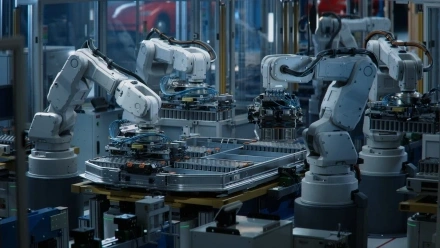
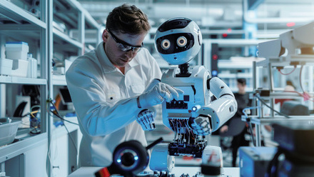
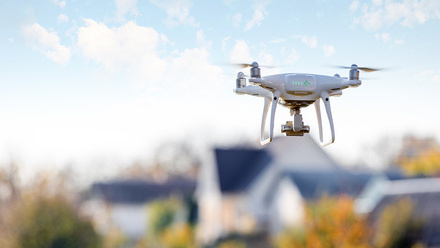
Running from February to June 2025, this sprint campaign is exploring how the UK can lead on the development, application and commercialisation of robotic & automation technologies.
These include autonomous vehicles, drones, humanoids, and applications across industry & manufacturing, defence, transport & mobility, logistics, and more.
Activity is taking the form of roundtables, workshops, panel discussions, networking sessions, tech demos, Summits, thought leadership pieces, policy recommendations, and a report (to be launched in Q4 2025).
Get in touch below to get involved or find out more about techUK's future plans in this space.
Upcoming events


Insights


Event round-ups
Get in touch
Rory Daniels
Rory Daniels
Rory joined techUK in June 2023 after three years in the UK Civil Service on its Fast Stream leadership development programme.
During this time, Rory worked on the Government's response to Covid-19 (NHS Test & Trace), school funding strategy (Department for Education) and international climate and nature policy (Cabinet Office). He also tackled the social care crisis on secondment to techUK's Health and Social Care programme in 2022.
Before this, Rory worked in the House of Commons and House of Lords alongside completing degrees in Political Economy and Global Politics.
Today, Rory leads techUK's five-strong Emerging Technology and Innovation team, working with many of the UK's most innovative tech companies to convene experts and decision-makers, showcase best practice, shape government's thinking, and ensure the UK leads on developing and deploying transformative technologies.
The team's main areas of focus are AI Innovation, Quantum, Semiconductors, Robotics, Photonics, Neuromorphic, Innovation Policy, and Technology Convergence.
Rory sits on DSIT's expert Robotics Advisory Group, hosts techUK's Meet the Innovators video interview series, and chairs techUK's Emerging Tech Leadership Committee, comprising 36 senior leaders from the UK's most exciting tech companies. He has also judged the Global Space Awards, hosted London Tech Week's Deep Tech Stage, completed Stanford University's Tech & Entrepreneurship residency, and given oral evidence in a House of Lords Select Committee.
In his spare time, Rory enjoys photography, reading non-fiction (tech, architecture, design & geopolitics), and searching for London's best burger.
- Email:
- [email protected]
- LinkedIn:
- https://www.linkedin.com/in/rorydaniels28/
Campaign Weeks
Our annual Campaign Weeks enable techUK members to explore how the UK can lead on the development and application of emerging and transformative technologies.
Members do this by contributing blogs or vlogs, speaking at events, and highlighting examples of best practice within the UK's tech sector.

Summits
Tech and Innovation Summit 2025
Tech and Innovation Summit 2023
Tech and Innovation Summit 2024
Receive our Tech and Innovation insights
Sign-up to get the latest updates and opportunities across Technology and Innovation.
Authors

Ryan McCollough

Ryan Degnan
