It’s time to talk about location
Location, Location, Location! Location, in its own right, is a key component of daily life.
As a customer, it’s essential. “I need that delivery! I need an ambulance!” As a householder, anywhere in the UK, it’s vital. “I need my bins collecting, my children need a bus that takes them to school, I need the street-lighting to work, I want those potholes fixed…” And as individuals, particularly at the moment, we need the tools to understand location in a whole new way. “I’d like to know where I can do some exercise, locally.”
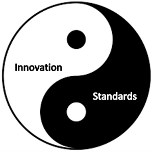
All of these needs are met either by industry or by an organisation that’s dedicated to helping us. In meeting these needs, business and government have created competition, stimulated innovation, and contributed to our economy – there’s a balance between Innovation and standardisation. Or, to put it another way, there’s a new relationship between “how can we find new ways to do this?” and “how can we be sure we’re doing this consistently, so other people can do it with the same enthusiasm and ability to deliver the same quality?” Yin and Yang; both have a place, both need to work in harmony.
It’s the role of government and industry to collaborate and bring these things together in a cohesive way. I sometimes hear that standardisation is the death of innovation, but I can’t agree. Standardisation is more like an evolution of innovation – it helps us to achieve more, more consistently. Key to standardisation is a clarity on definitions and industry acknowledgement and acceptance. A standard has no practical application if no-one knows about it and doesn’t do the job it was tasked to do.
Here’s an example: In 2004, location standards were used to create Land and Property Gazetteers – highly innovative concepts at the time. The idea was simple. Bring every local authority together and create a national repository of street and address information for use across the public and private sector. This national initiative created standards that are now widely accepted across industry. Making our household services more efficient, helping us to overcome the health crisis – finding vulnerable householders, getting them the help they need. See examples of local authority case studies here.
The standardised identifiers that make those Gazetteers possible – the Unique Street Reference Number (USRN) and Unique Property. Reference Number (UPRN) – are available under Open Government Licence terms. Everyone can benefit from those standards, and problem-solve by connecting data and systems in a way that stimulates innovation.
To enhance our geospatial ecosystem – the network of businesses and organisations involved in defining and making location-data more available for use in innovative applications – the UK’s Geospatial Commissions outlined what was needed to nurture the UK’s growing geospatial economy.
It commissioned Frontier Economics to provide an economic study of the size, features and characteristics of the UK geospatial data market which suggested that the data accounted for over £6 billion of turnover in 2018, and that there are three interesting, main characteristics of the geospatial market.
- Geospatial activity takes place in an ecosystem and not a single market
- If we use traditional methods to measure geospatial commercial activity, we don’t see it its full value
- Creating and using geospatial data leads to spill-over benefits.
Data and technology are catalysts for innovation and collaboration. In the transport sector specifically, recent advances give us cause to celebrate. The Geospatial Commission recently partnered with Innovate UK in a competition to stimulate the marketplace and innovation in geospatial initiatives across four key areas relating to the Future of Mobility:
- promoting active travel
- enabling mobility as a service
- managing supply chains
- increasing capacity.
See the winners here. Additionally, the Department for Transport’s Office for Science is supporting 23 research and innovation projects in the 7th year of the Transport-Technology Research and Innovation Grants Programme (T-TRIG).
There are endless opportunities out there for innovation and collaboration, making good use of location identifiers like the UPRN and USRN. Do you have a use case you’d like to explore, or have an idea about using an identifier to create interoperability with other standards? Please get in touch.
You can read more insights from techUK's #GeospatialFuture campaign here!