Geospatial Technology, behind the scenes getting the Blue Dot to the Blue Lights
Do you remember the last time you dialed 999?
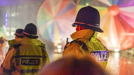
Fortunately it is a rare occurrence for most of us, but it is always a stressful event representing a time of personal concern, the experience of a crime, a health emergency or risk to people and property. We are extremely fortunate in the UK to have an integrated professional team of emergency services workers able to respond quickly to these “calls for help” and robust and secure IT systems developed over decades to support them. One of the key pieces of information these system need to communicate is the location of the individual calling for assistance, once upon a time when all calls were made from a fixed line, it was relatively easy to dispatch emergency services to the address of the subscriber, now the vast majority of 999 calls are made from mobile phones, prompting the common question - “Where are you?”
Where are you ?
We have all seen the police procedural shows so popular on TV where the grumpy Detective Inspector asks the young Detective Constable to obtain the “Mobile phone data” of the victim or suspect and a little later on everyone gathers around the screen to look at the map highlighting the area to search…
Of course for mobile communications networks to work, our phones need to communicate with nearby cellular radio sites which provide them with a signal, and to allow an incoming call to be directed to your phone via the correct cell site, the system needs to keep track of the location of phone relative to nearby cell sites. This is the information that has also traditionally been used to help locate someone dialing 999 from their mobile phone, however 3G and 4G cell sites may provide quite large areas resulting in location estimates often being hundreds of metres if not many kilometres wide in rural areas.
But your smartphone has a much more precise estimate of your location, that little blue dot on your map app is often accurate within a few metres indoors as well as outside and is used my many apps on your phone to provide directions, local weather forecasts, food delivery and even to tell you when the next bus is due and during these strange times how crowded it might be.
The technology behind the blue dot it a great example of the hidden nature of Geospatial Technology, what we might think of simply as “GPS” is actually a combination of many space based positioning and timing technologies including yes GPS, but also the European Galileo, Russian GLONASS and Chinese BeiDou systems. In dense urban canyons and indoors where the very weak signal coming from space is impossible to receive other nearby radio transmitters such as wifi hotspots and bluetooth beacons made be used along with sophisticated inertial navigation techniques similar to those used on the Apollo missions to the moon are used to make sure that blue dot always represents the most accurate location possible.
Getting the blue dot to the blue lights…
You might have reasonably assumed that when you dialed the emergency services that the blue dot location was shared with the emergency services, afterall if Uber or Deliveroo know where you are calling from… unfortunately because the systems that provide location to the emergency services predate smartphones and their capabilities this was not the case, the network based location estimate based on cell site location was all that was available.
A few years ago a successful partnership between BT the emergency call infrastructure provider, handset manufacturers and mobile network operators developed what would be described in California as a “scrapy” solution to the problem. With existing technological components how can the device based location be shared in a secure, privacy preserving way with the emergency services whenever someone dials 999. A key driver is privacy, location sharing is particularly sensitive, so that the caller's location should only be shared with the emergency services not the handset supplier or any other third party. The solution has become known as Advanced Mobile Location or AML and if you own an Apple or Android smartphone since 2018 your handset's precise location has been shared with the emergency services whenever you dial 999 from your smartphone.
AML works by watching out for the emergency number to be dialled and then if required switching on your phones location services for the duration of the call, many people switch off location services to conserve battery life, the “blue dot” device derived location is obtained and then sent as a data SMS invisible to the user to BT and then onto the relevant control rooms of the emergency services. On ending the call the location services are shut down once again. This all works behind the scenes as is often the case with Geospatial technology, the solution has become integrated into your phones operating system, so does not require any additional app to be installed at a time of understandable stress.
The use of an “old” technology such as SMS means the solution is robust and although there are more elegant solutions built into modern 4G and 5G networks the scrappy solution works in a robust fashion on existing networks and has now been deployed in more than twenty countries around the world and is saving lives every day by making sure the emergency services call locate callers quickly.
An early study into the value of accurate location sharing to emergency services in 2016 estimated that up to 7,500 lives and 95 billions could be saved in Europe over the following ten years.
But it is the personal stories that really illustrate the value of this behind the scenes Geospatial Technology, Keen paraglider Andreas Gremmel crashed in a remote alpine area of Austria, injured and with no idea of his location he was able to call the emergency services using a weak mobile phone signal. The call was enough to allow his “blue dot” location to be shared with the emergency services with an accuracy of just 6m and the dispatched emergency services found him within the hour!
Andreas was not aware of the Geospatial technology that day working to save his life, and neither should be have, a favorite quote of mine from the influential technologist Mark Weiser sums this up nicely “The most profound technologies are those that disappear. They weave themselves into the fabric of everyday life until they are indistinguishable from it.”
You can read more insights from techUK's #GeospatialFuture campaign here!